SGSMI.ORG
SGS HOME PAGE
INDEX PAGE
Table of Contents
Links
Libraries
>
Saginaw FHC
Hoyt Public Library of Saginaw
Library of Michigan
Allen County Library
MidWest Genealogy Center
SLC Family History Library
SAGINAW COUNTY
Military
Cemeteries
>
Headstones
County Poor Farm
County Schools List
County Atlas
County Map
Funeral Homes
Historical Churches
Publications
Courthouse Index
NEWS & MORE
WHAT'S NEW - JUN 2024
Ask Miss Betty
Calendar Page
Mystery Photos
CERTIFICATES
>
SGS CERTIFICATES
SGS ANCESTRY PAGE
HISTORIES
First Land Purchases
19th Century Emigrants List
Newspapers
>
Saginaw Daily Courier
Saginaw Daily Enterprise
History of Bridgeport
History of Frankenmuth
History of Saginaw
Midland County Marriages
HISTORY OF SGS
MEMBERSHIP
ZOOM REGISTER FORM
About Us
>
SGS BOARD 2023-24
By-Laws & Constitution
Donate
Request Membership
Payment page
CONTACT INFO Page
MEMBERS
2024-25 SGS ELECTION FORM
Archives of the TTL
>
Index and Table of Contents
Archives of SGS Newsletter
>
Index and Table of Contents
Old News
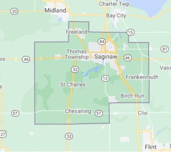
CURRENT MAP OF
SAGINAW COUNTY
CLICK BUTTON TO ACCESS GOOGLE MAP
SAGINAW COUNTY, MICHIGAN